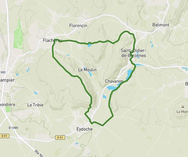
This hiking trail covers 7.445mi starting from Saint-Didier-de-Bizonnes, Isère. The hike is a loop trail and returns to the trailhead. This hike is rated as hard, plan for about 2h40m to complete it. The route has an elevation gain of 1050ft and an elevation loss of 1050ft.
Depuis Saint Didier en passant par les yourtes et Le Marc
Route details
2.79mph
Speed
1170 kcal
Calories burned
5.3%
Avg grade
Loop trail
Route type
1775ft
Min altitude
2247ft
Max altitude
Route profile
1050ft
Elevation gain
1050ft
Elevation loss
1775ft
Min altitude
2247ft
Max altitude
How to get there
Trailhead: Impasse Des Églantiers, 38690 Saint-Didier-de-Bizonnes
GPS coordinates of the trailhead: 45.46447, 5.34977 / 45°27'52'' N, 5°20'59'' E