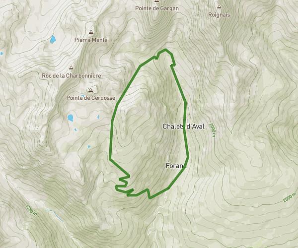
This hiking trail covers 9.095mi starting from Montvalezan, Savoie. The hike is a loop trail and returns to the trailhead. This hike is rated as strenuous, plan for about 4h to complete it. The route has an elevation gain of 3186ft and an elevation loss of 3176ft.
Parcours 1
Route details
2.27mph
Speed
1866 kcal
Calories burned
13.2%
Avg grade
Loop trail
Route type
3360ft
Min altitude
6093ft
Max altitude
Steep climb
Route profile
3186ft
Elevation gain
3176ft
Elevation loss
3360ft
Min altitude
6093ft
Max altitude
How to get there
Trailhead: 424 Rue Des Eucherts, 73700 Montvalezan, France
GPS coordinates of the trailhead: 45.62527, 6.86325 / 45°37'30'' N, 6°51'47'' E