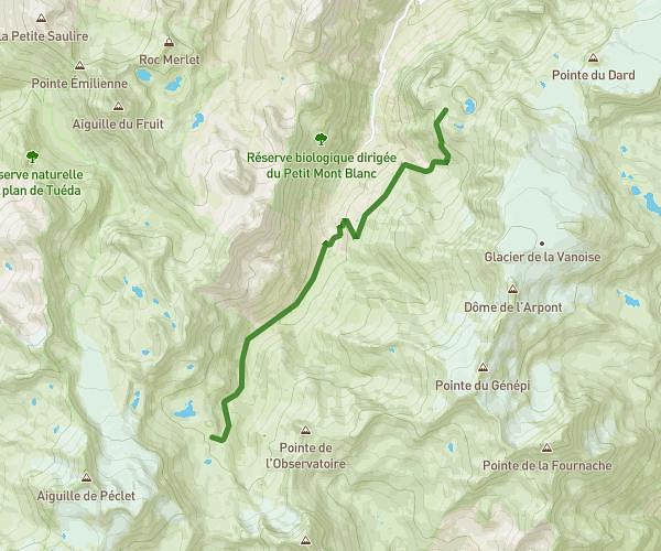
This hiking trail covers 6.314mi starting from Courchevel, Savoie. The hike does not return to the trailhead and ends near 124 Rue De Bellecôte, 73120 Courchevel, France. This hike is rated as strenuous, plan for about 2h32m to complete it. The route has an elevation gain of 623ft and an elevation loss of 3596ft.
Arête Saulire et Col du Fruit
Route details
2.49mph
Speed
1100 kcal
Calories burned
12.7%
Avg grade
Point to point
Route type
5837ft
Min altitude
8812ft
Max altitude
High altitude
Steep climb
Route profile
623ft
Elevation gain
3596ft
Elevation loss
5837ft
Min altitude
8812ft
Max altitude
How to get there
Trailhead: 73120, Courchevel, Savoie, France
GPS coordinates of the trailhead: 45.382966, 6.610797 / 45°22'58'' N, 6°36'38'' E