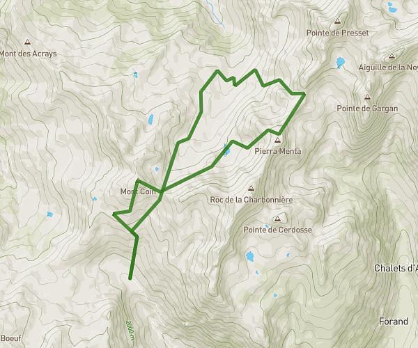
This hiking trail covers 11.881mi starting from Pralognan-la-Vanoise, Savoie. The hike is a loop trail and returns to the trailhead. This hike is rated as strenuous, plan for about 9h33m to complete it. The route has an elevation gain of 4718ft and an elevation loss of 4724ft.
les 3 lacs de la vanoise
Route details
1.24mph
Speed
4519 kcal
Calories burned
15.1%
Avg grade
Loop trail
Route type
4672ft
Min altitude
8399ft
Max altitude
High altitude
Steep climb
Route profile
4718ft
Elevation gain
4724ft
Elevation loss
4672ft
Min altitude
8399ft
Max altitude
How to get there
Trailhead: 40 Rue Des Lauzes, 73710 Pralognan-la-Vanoise, France
GPS coordinates of the trailhead: 45.37945, 6.723911 / 45°22'46'' N, 6°43'26'' E