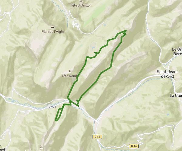
MapPlanner
5.136mi
Distance
3h45m
Duration
1.37mph
Speed
2894ft
Elevation +
2887ft
Elevation -
3330ft
Min altitude
5892ft
Max altitude
Difficult
Level

Pointe de la Fougère

View from the tip of the Fougère
View from the Pointe de la Fougère on the Bauges

Route details

Explore this hiking route of 5.136mi starting from Jarsy, Savoie. The hike is a loop and returns to the starting point. This hike is rated as difficult, plan for about 3h45m to complete it. The route has a positive elevation gain of 2894ft and a negative elevation loss of 2887ft.

Description of the route by the creator

From the parking of the Nant Fourchu (last parking accessible by the road), follow the signs to the Fougère d'en Haut and then the pointe de la Fougère.

(Description automatically translated)
Bauges

Route profile

2894ft
Elevation +
2887ft
Elevation -
3330ft
Min altitude
5892ft
Max altitude

How to get there

Route starting point: 73630 Jarsy

GPS coordinates of the starting point: 45.6458, 6.23706 / 45°38'44'' N, 6°14'13'' E