MapPlanner
8,854mi
Distance
4h48m
Duration
2,21mph
Speed
3829ft
Elevation +
3796ft
Elevation -
3780ft
Min altitude
7201ft
Max altitude
Difficult
Level

Pointe de la Sambuy depuis la station de la Sambuy

View of the Pointe de la Sambuy from the top of the resort
Nice view on the Mont-Blanc during the climb
The tip of the Sambuy from the small Sambuy
View from the point: the Arcalod on the left and Le Trélod just beside it
View on the north-east and the Mont-Blanc from the point
The small Sambuy from the top and the lake of Annecy

Route details

Explore this hiking route of 8,854mi starting from Faverges-Seythenex, Haute-Savoie. The hike is a loop and returns to the starting point. This hike is rated as difficult, plan for about 4h48m to complete it. The route has a positive elevation gain of 3829ft and a negative elevation loss of 3796ft.

Description of the route by the creator

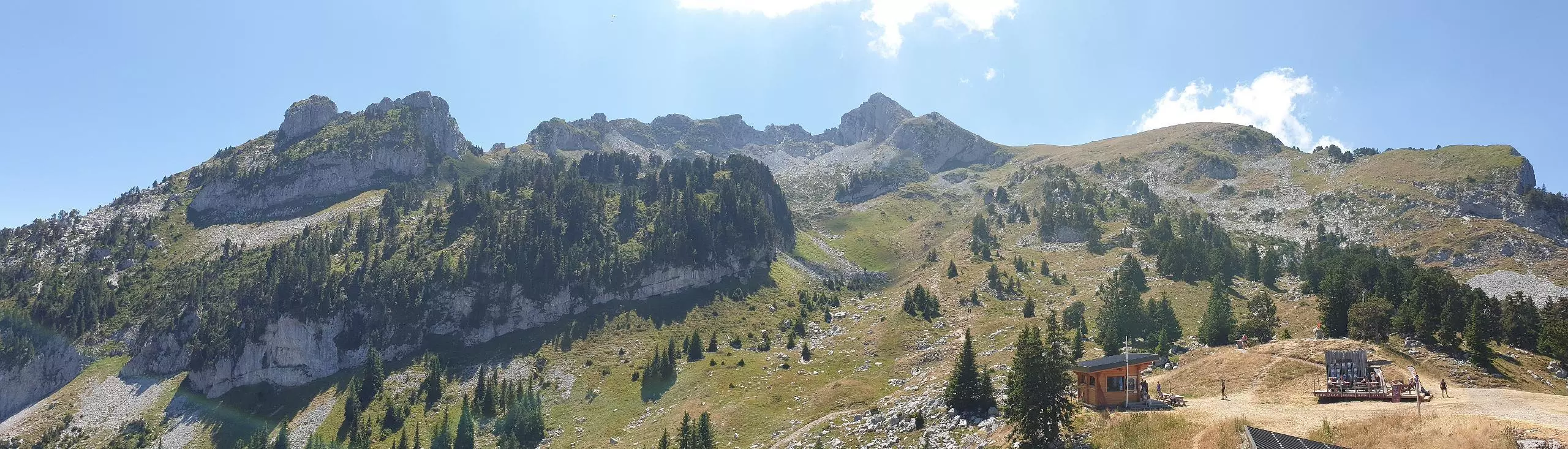
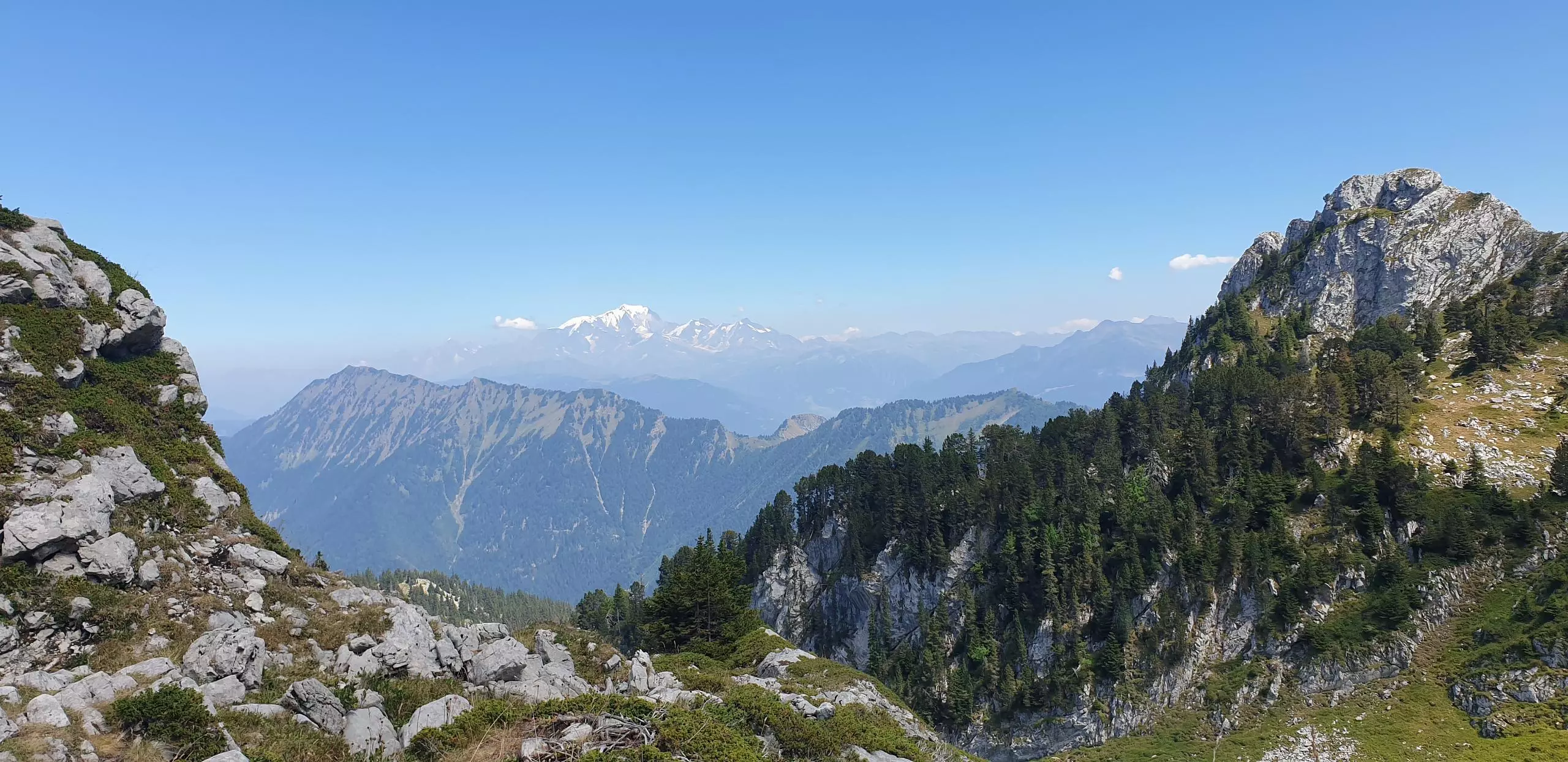
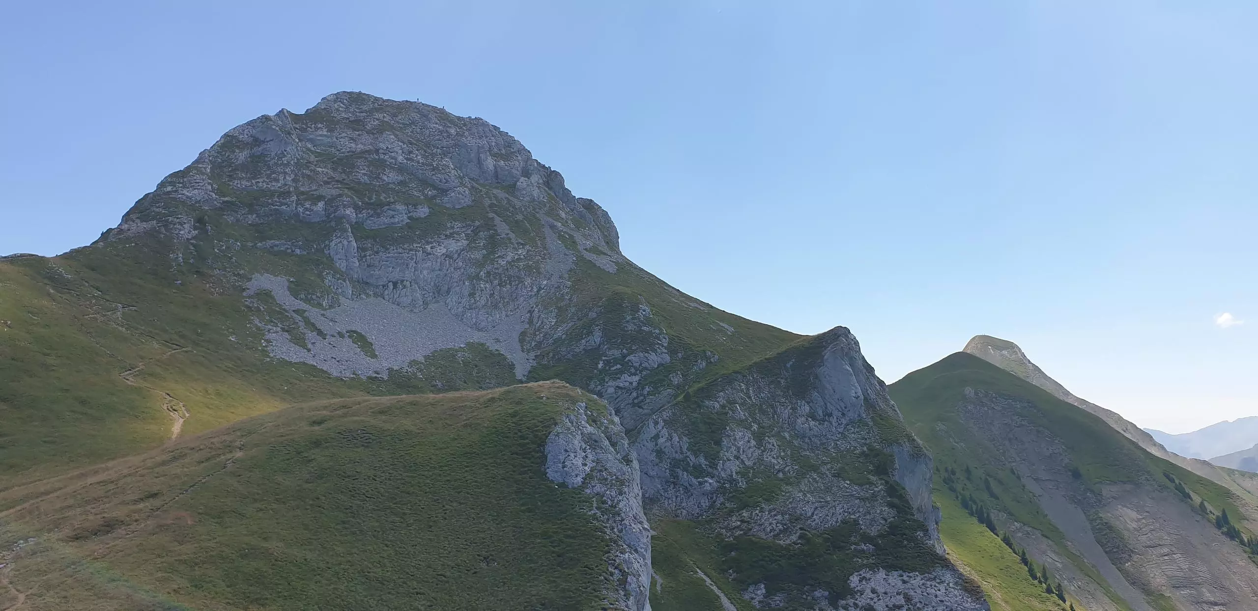
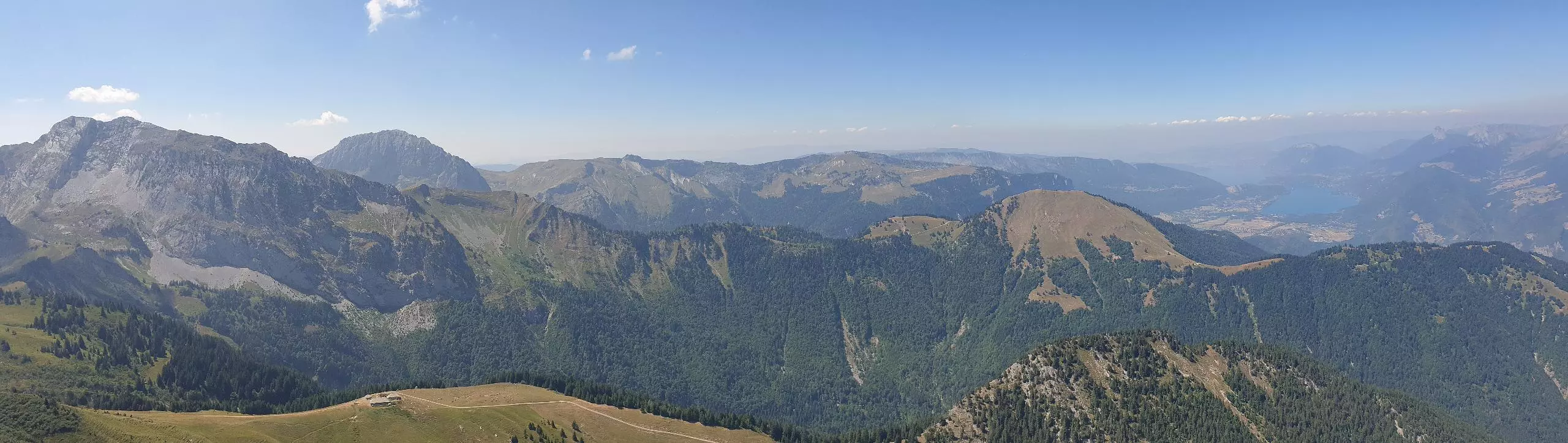
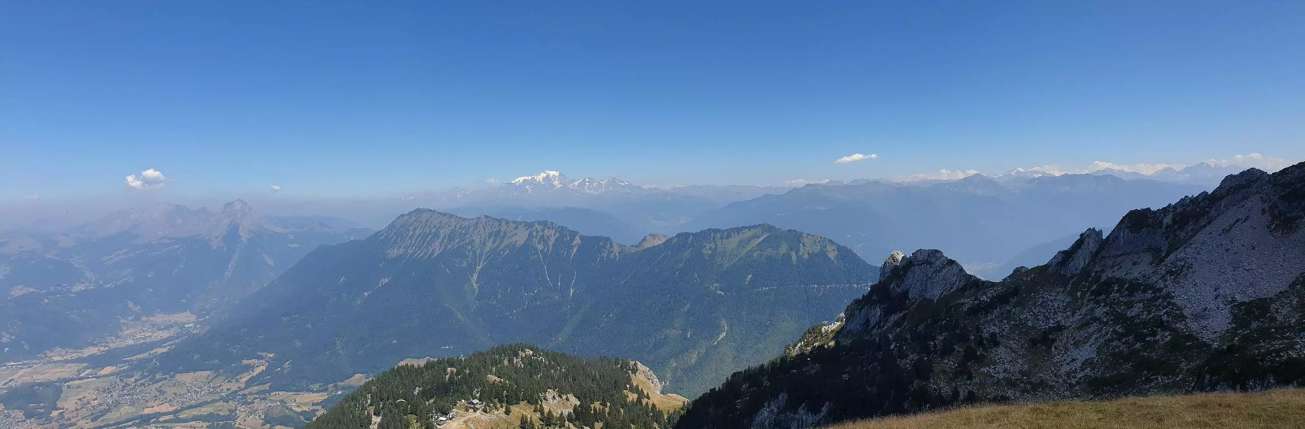
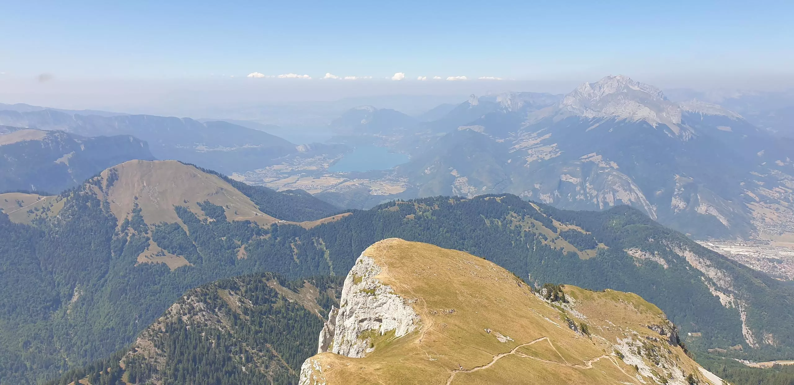
Park at the large parking lot of the Sambuy resort. Follow the signs to the top of Sambuy and then turn right to continue on the wide path. It is also possible to take the same path for the outward and return journey. This allows you to make a loop. Once arrived at the combe de Sambuy, follow the signs to the col de la Sambuy. Turn right to reach the small Sambuy and see the view on the lake of Annecy. Then go back and take the blue marked path to reach the top of the Sambuy peak. Be careful, this path is very steep and you have to use your hands to climb to the top. Do not do it if you have vertigo. Go back down to the combe de Sambuy then follow the signs to go back to the station through the Pas de l'Ours.

(Description automatically translated)
Bauges

Route profile

3829ft
Elevation +
3796ft
Elevation -
3780ft
Min altitude
7201ft
Max altitude

How to get there

Route starting point: L'avalanche, 74210 Faverges-Seythenex

GPS coordinates of the starting point: 45.7136, 6.27417 / 45°42'48'' N, 6°16'27'' E