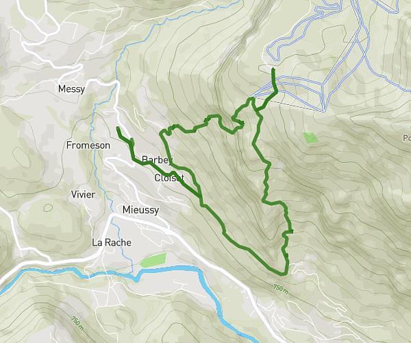
This hiking trail covers 9.113mi starting from Machilly, Haute-Savoie. The hike is a loop trail and returns to the trailhead. This hike is rated as strenuous, plan for about 4h to complete it. The route has an elevation gain of 3182ft and an elevation loss of 3179ft.
Les voirons
Route details
2.28mph
Speed
1865 kcal
Calories burned
13.2%
Avg grade
Loop trail
Route type
1729ft
Min altitude
4777ft
Max altitude
Steep climb
Route profile
3182ft
Elevation gain
3179ft
Elevation loss
1729ft
Min altitude
4777ft
Max altitude
How to get there
Trailhead: 73 Route Des Voirons, 74140 Machilly, France
GPS coordinates of the trailhead: 46.2513, 6.32938 / 46°15'4'' N, 6°19'45'' E