MapPlanner version 3.0
Thanks to your support, MapPlanner continues to grow, with the milestone of 50,000 unique visitors per month well exceeded!
This new version features a brand-new interface, making it even easier to calculate your rides.
Start by entering your starting point (address, city, or location), and let our automatic route calculator guide you for running, walking, hiking, or biking. View elevation gain to assess route difficulty and choose your preferred map style (street, satellite, or outdoor map).
Select the activity type (jogging, trail, walk, or bike) to automatically calculate the estimated duration of your route. Your previous performance is also considered for a more accurate estimate.
Plan my routeSave your routes (runs, hiking trails, bike rides) and add photos to share with the community. Plan your next routes using thousands of member rides from all over the world (based on duration, time, distance, altitude difference or average speed).
Plan my routeUse our route planner to map your run, walk, or bike ride and measure the distance accurately. The route automatically adapts to your activity (running, cycling, walking, or hiking). Display distance in kilometers or miles.
See elevation profiles in feet or meters along your route. Instantly view the highest and lowest points to assess difficulty.
Calculate the duration of your run, walk, hike, or ride in just one click. Estimates also consider your previous routes for improved accuracy.
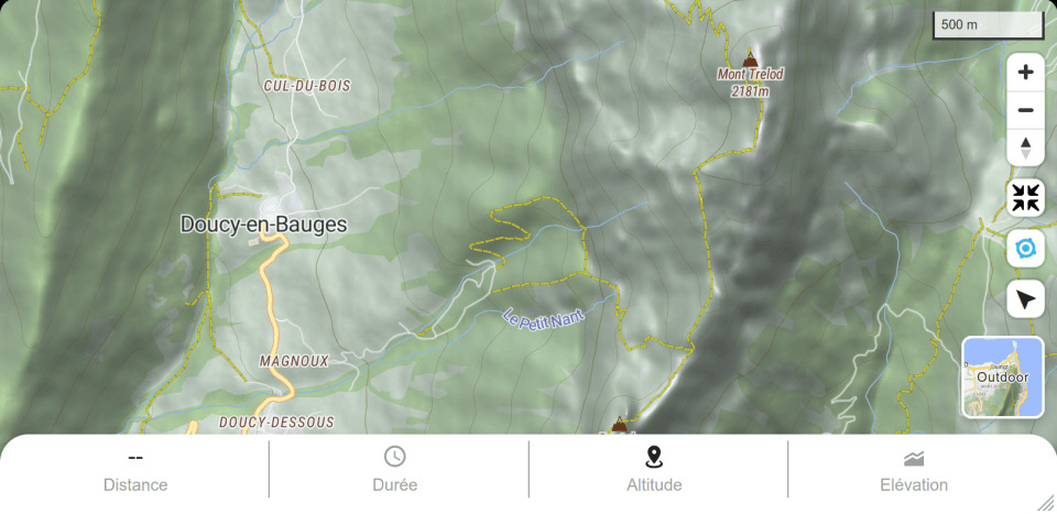
Choose the map that suits your activity: jogging map, outdoor map (with contour lines and shading), or satellite view.
Search over thousands of outdoor activities (hiking, cycling or walking) and photos to find the nicest routes according to your level or time available.

Export and import routes from your smartwatch (Garmin, Suunto, Polar, Huawei, Amazfit, Samsung, etc.). If your watch tracks heart rate, you can also view the heart rate graph.
Images with coordinates are automatically positioned on the map as points of interest!
Track your performance for each activity (running, jogging, cycling, or hiking) over time. Share your routes with the community and compare results.

Found a location you'd like to explore? Mark it directly on the map and associate a route later to guide you during your activity.

How can I follow my route in real-time on my smartphone? Using Explorer mode (for subscribers), you can see your real-time location and orientation on the map. Stay on track and never get lost!

Thanks to MapPlanner, I planned an 8 km jogging route around my home in just a few minutes. The distance and estimated time were perfect for my morning run before work.
With the isochrone mode, I can plan my hikes in no time! I instantly see where I can go with my available time. The GPS tracking is great to make sure I never get lost in the mountains.
We prepared a 40 km cycling loop with friends and exported the GPX track. Everyone followed the same route on their watch without getting lost. Perfect organization!
Before a forest hike, I checked the elevation and duration. The route followed real trails, which saved me from unpleasant surprises. Very reliable!
I wanted an easy walk for my kids. I set a maximum of 5 km and MapPlanner helped me create the perfect loop. We had a wonderful family moment.
I love planning my outings in advance. I saved several routes for the weekends. It saves me so much time.
By exploring the routes around my home, I discovered great paths I didn’t know at all. MapPlanner opened new areas for me to explore.
I keep an eye on my progress thanks to the history feature. I compare my running speed and distance over the months — it’s motivating!
For our MTB club outing, we created the route and sent the GPX to everyone. Result: no one got separated, the whole group stayed together from start to finish.
I love taking photos while hiking. MapPlanner automatically places my pictures on the map. It’s fantastic to review the route and share it with friends.
Depending on the activity, I switch the map style: topo for the mountains, street for the city, satellite to spot areas. It makes preparation super intuitive.
MapPlanner now estimates my times based on my own pace. I know exactly how long my next outing will take. Perfect for last-minute planning.
Unlock all premium features and enhance your route planning
7-day free trial available
The free version allows you to draw, view and export routes but with limitations. The paid “Explorer” version adds:
The Explorer subscription gives you access to all premium features: unlimited reachable zones, real-time GPS tracking, premium maps, unlimited 3D views, advanced GPX export and much more.
You can request a refund within 30 days after the initial purchase by contacting our support team.
Discover the latest MapPlanner news and innovations
Thanks to your support, MapPlanner continues to grow, with the milestone of 50,000 unique visitors per month well exceeded!
This new version features a brand-new interface, making it even easier to calculate your rides.
We're proud to launch MapPlanner subscriptions, giving you access to even more features with unlimited use!
Subscribing to the Explorer version allows you to :
Following your feedback, new features have been added to explore and create more easily your routes and itineraries (walking courses, hiking, ...).
The site is now translated in 5 languages:
If...