Pack the right amount of food and pick the right shoes: MapPlanner works out the calories you will burn on a hike, a trail run or a bike ride. It also shows what surface you will be on, from asphalt to dirt track, section by section.
How calories burned are calculated
As soon as you draw a route, the calories appear in kilocalories in the route details under the map. The calculation uses MET values (metabolic equivalent of task), a standard measure of how intense an activity is:
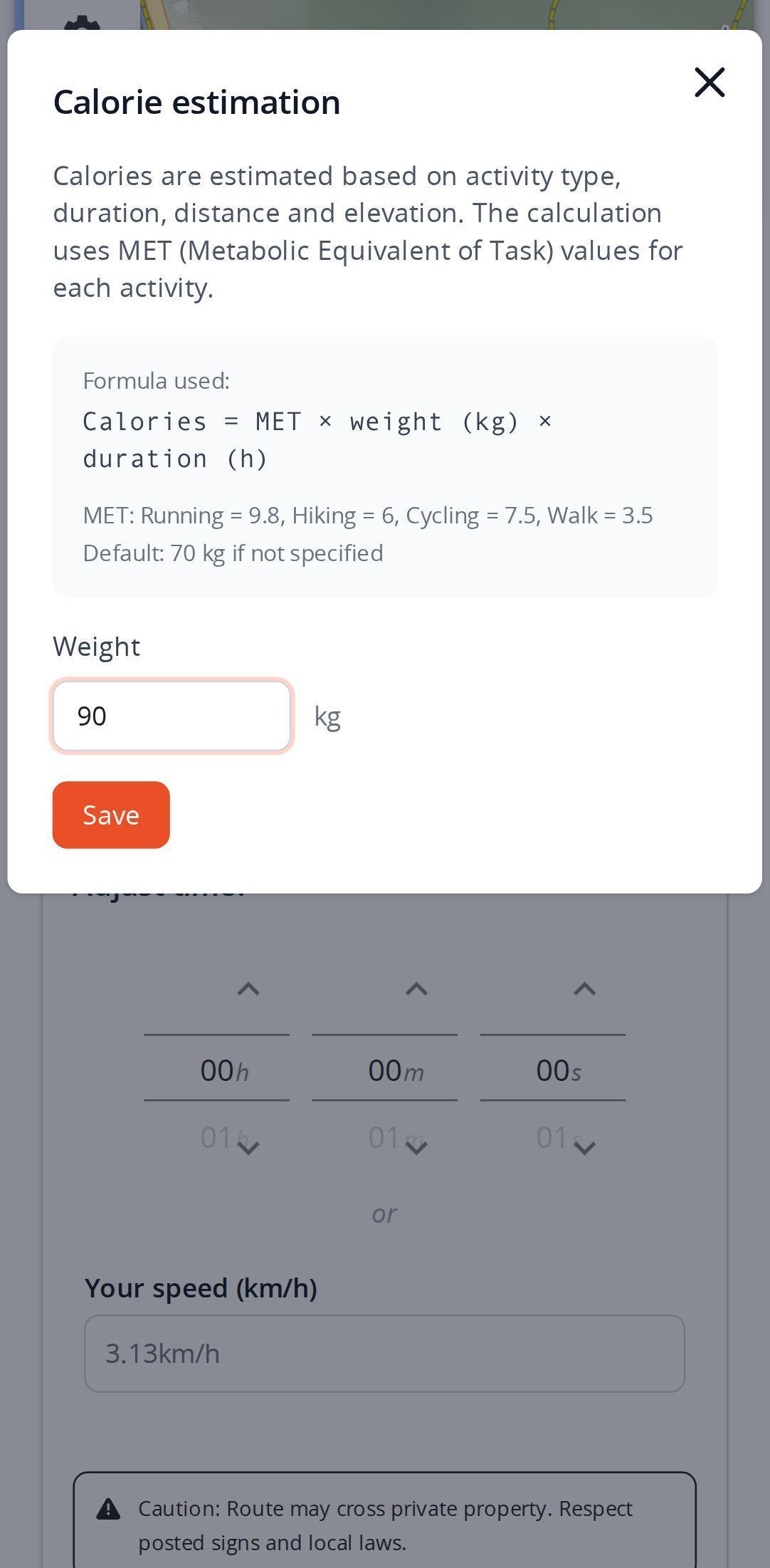
calories = MET × weight (kg) × duration (h)
MapPlanner uses 9.8 for running, 6.0 for hiking, 7.5 for cycling and 3.5 for walking. For hiking and cycling, the intensity rises with the elevation gain relative to the distance, read from the elevation profile: over the same distance, a hilly route burns more than a flat one. The duration used is the route's estimated duration or the one you entered yourself.
Plan your own route
MapPlanner helps you calculate distances, elevation, duration and plan your hikes, runs and bike rides on an interactive map.
- Automatic distance & elevation calculation
- Topographic, satellite maps
- GPX/KML export for your GPS
- Real-time GPS tracking
Add your weight for a closer estimate
Without any information, the calculation assumes 70 kg. The small icon next to the calories opens a window that explains the formula and the values per activity, where you can enter your weight in kilograms or pounds depending on your units. Without an account it stays in your browser; with a free account it is saved to your profile and follows you from one device to another.
Know the surface type of a route
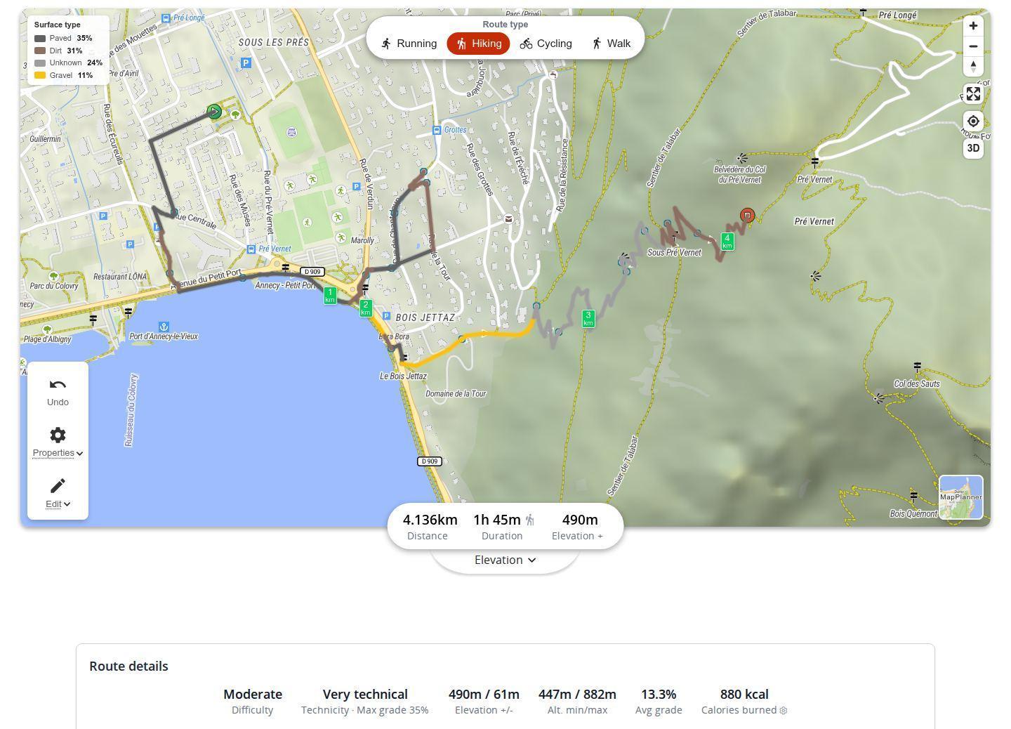
In the map properties, surface coloring paints each section by what is underfoot: paved, compacted, gravel, dirt, grass or woodland. A legend gives the share of each one on the route, for example a hike that is mostly dirt with a little asphalt on the way out of the village. An "unknown" share covers sections whose surface is not recorded in the path data.
The map properties can also color the route by slope: only one coloring is shown at a time, to keep the map readable. For hiking, the share of unpaved paths also feeds the technical level shown with the difficulty level.
Average gradient in a single figure
For hiking and cycling, the route details also show the average gradient: all the climbing and descending divided by the distance. A high figure means a route that rarely lets up, even if its distance looks modest. Once the route is saved, its page keeps the calories and average gradient; surface coloring is still available on its map.
Food, shoes and tires: our tips
- Plan your food from the estimated calories: on a long hike, one snack too many beats running out of energy two hours from the finish.
- For trail running, lots of dirt or grass calls for grippy shoes; lots of asphalt, a more cushioned pair.
- On a road bike, make sure the route does not switch to gravel or dirt; on a gravel bike, look for exactly those sections.
- With a stroller, go for routes that are mostly paved or compacted.
- A big unknown share? Zoom in on those sections and look at the base map: it often shows whether it is a road or a footpath.
Calories, weight, surface coloring and average gradient are free and work without an account. Draw your next outing in the planner to see what it will cost you and what you will be walking on.
Calories and surfaces: quick answers
How many calories does hiking burn?
It depends on the duration, your weight and the terrain. MapPlanner estimates it for your route with the formula MET × weight × duration, raising the intensity when the route climbs a lot.
How accurate is the calorie estimate?
It is based on standard values for each activity. Entering your weight makes it closer; your fitness and actual pace will still make it vary.
How can I tell if a route is paved or dirt?
Turn on surface coloring in the map properties: the route is colored by surface and the legend gives the share of paved, gravel, dirt and other surfaces.
Do I need an account to save my weight?
No. Without an account your weight is kept in your browser. With a free account it is saved to your profile.


