Saturday's group: a trail runner, two Sunday walkers, a friend getting back into it after years off and a ten-year-old. To judge how hard a hike is before choosing one that suits everybody, MapPlanner gives every route a difficulty level worked out from the terrain, plus how technical the path is for hiking and a breakdown of the climbs for cycling.
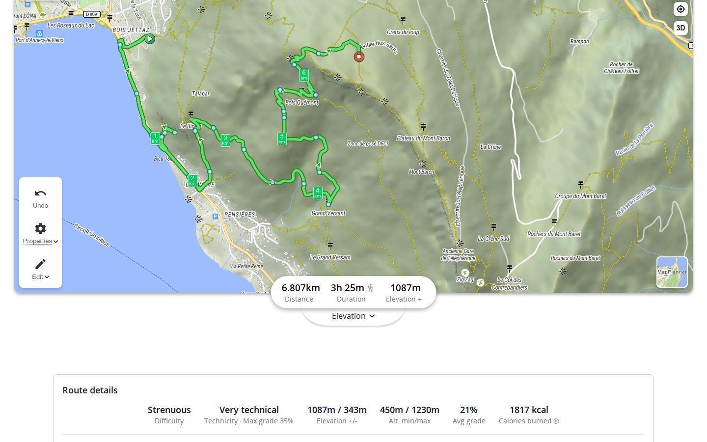
Five difficulty levels, worked out from the route
The level runs from very easy to strenuous. It sits in the route details under the map and updates every time you edit the route. The method depends on the activity, because the same route does not ask the same of you on foot and on a bike:
- hiking and cycling: the calculation draws on the effort indexes used by hikers and cyclists. Each section is graded by its slope, read from the elevation profile, uphill and downhill alike: the steeper it is, the more it counts. The result is then combined with the distance;
- running: the level follows the distance, from very easy under 5 km to strenuous beyond 18 km;
- walking: same idea with shorter steps, suited to an easy stroll.
Switch activity above the map and the level adjusts straight away, along with the estimated duration.
Plan your own route
MapPlanner helps you calculate distances, elevation, duration and plan your hikes, runs and bike rides on an interactive map.
- Automatic distance & elevation calculation
- Topographic, satellite maps
- GPX/KML export for your GPS
- Real-time GPS tracking
Technical level: what the trail feels like underfoot
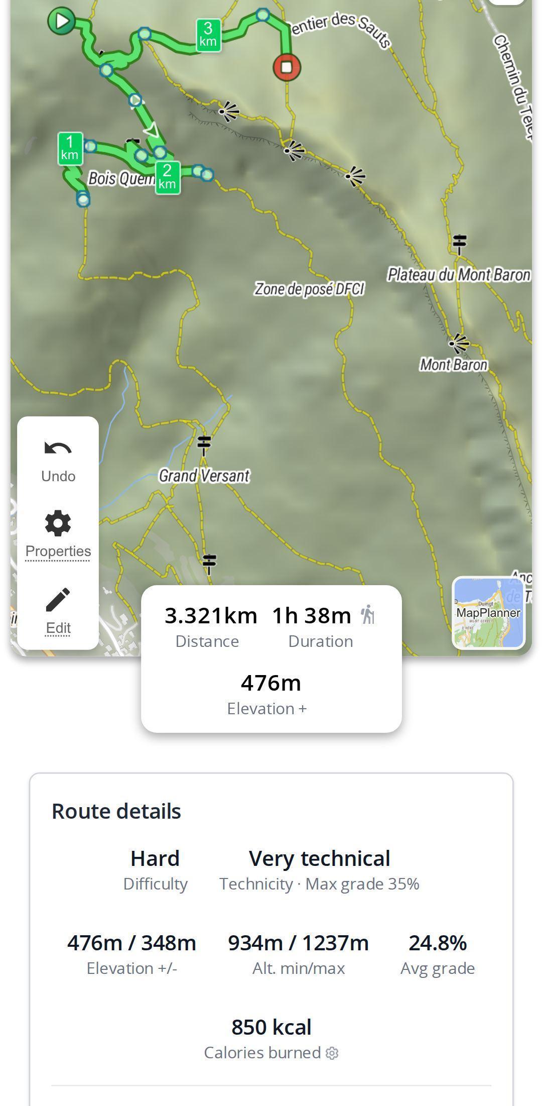
Two hikes at the same level can be nothing alike. A long forest track wears you out; a short rocky path along a mountainside needs your full attention. That is what the technical level measures for hiking: easy, technical or very technical. It combines the steepest gradient held over about a hundred meters with the share of unpaved paths. A pitch of 25% or more on a mostly dirt route therefore comes out very technical, even over a short distance.
The matching maximum gradient is shown alongside, so you know what the steepest bit looks like before you reach it.
On a bike, difficulty lives in the climbs
For a cyclist, most of the effort usually comes down to two or three climbs. Under the map, the climbs list shows them one by one with their length, elevation gain, average gradient and maximum gradient. Each gets a category based on its elevation gain and average gradient, from a short bump through categories 4 to 1 up to hors catégorie.
Picking a route that suits every level
- Aim for the least trained person. With a mixed group, an easy or moderate route lets everyone enjoy the day; the fittest can save their legs for next time.
- With children, check the technical level as well as the difficulty: an easy but very technical hike goes down worse than a moderate one on a good path.
- Compare two variants by editing the route: a detour through the valley can sometimes drop a whole level.
- Cross-check with the duration: an easy six-hour route is still a long day for small legs.
- Read the alerts on the route page: above 2,500 m on a hike or run, a high-altitude badge appears; another flags a high average gradient on a hike or bike ride.
Adjust the level and sort your routes
Once the route is saved you still have the final say: if the calculated level does not match the ground, pick another one in the route form. The level also works as a filter, in the route search and in your list of activities, so you can find easy outings or big days in seconds.
Difficulty, technical level and the climbs list are free and work without an account, on desktop or phone. Draw Saturday's route in the planner and make sure it suits the whole group.
Route difficulty: what people ask us
How do I know if a hike is difficult?
Draw it in MapPlanner with hiking selected: the level, from very easy to strenuous, takes the distance and the gradient of each section into account; the technical level tells you whether the ground is steep and rough.
What is the difference between difficulty and technical level?
Difficulty measures the overall effort of the route. The technical level, calculated for hiking, describes the ground: the steepest gradient and the share of unpaved paths.
How is the difficulty of a running route calculated?
For running it depends on distance: under 5 km a route is very easy, beyond 18 km it is strenuous, with three steps in between.
Can I change a route's difficulty level?
Yes. Once the route is saved with a free account, its form lets you choose a different level.


