Where should you hike this weekend? With MapPlanner you can find hiking routes around any place or type an address to start drawing your own. Two kinds of search, one goal: getting to your next outing fast, on foot or by bike. Community routes can be filtered by activity, difficulty, distance and time; the planner jumps straight to the village or summit you pick. Free, no account needed.
Search for a place to start your route
At the top of the planner, just above the map, the search field takes an address, a street, a village, a town, a region or a peak. Suggestions appear after the first few letters, each with an icon showing what kind of place it is.
What you pick decides what happens next. An address becomes your start point straight away. A village or a region centers the map on the area, so all that is left is to click and place your first point. You can also skip typing altogether and start from your current position or click the map to set the start. Then draw your route as usual.
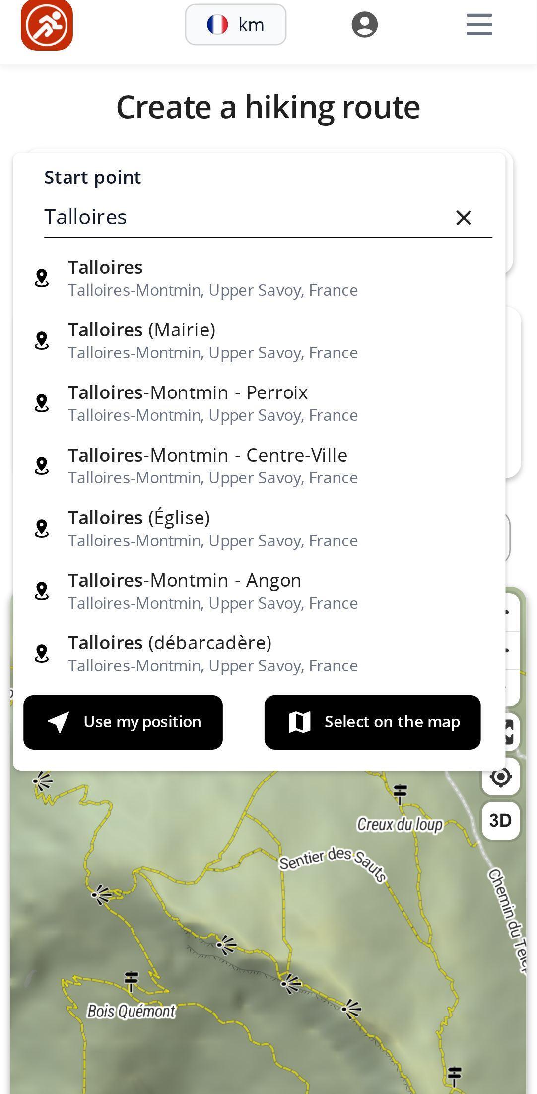
Your recent searches stay within reach below the field, so there is no need to retype an area you have been preparing for days. If a route is already on the map, MapPlanner asks before clearing it to start again from the new place.
Plan your own route
MapPlanner helps you calculate distances, elevation, duration and plan your hikes, runs and bike rides on an interactive map.
- Automatic distance & elevation calculation
- Topographic, satellite maps
- GPX/KML export for your GPS
- Real-time GPS tracking
Discover hiking routes others have drawn
No firm plan yet? The route search page is built for inspiration. Type a place, a town or a route name: the map shows the results and the list sets them out alongside.
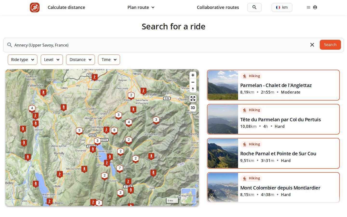
Four filters narrow things down. First the activity type: running, hiking, cycling or walking. Then the difficulty level, from the easiest to the most demanding. Finally distance and time, each set with a slider so you only keep the outings that fit your window.
Map and list stay in sync. On a computer, hover over a result to see its track appear; routes visible in the current area move to the top. With nothing typed, just pan the map to explore an area. Like the look of one? Its page shows reviews, photos and how to reach the start.
Routes by town and region
MapPlanner also has pages for countries, regions and towns. Each gathers the community routes in that area on a map, with a few key figures: number of routes, average distance and, for hiking and cycling, average elevation gain. A button opens the planner already centered on the place if you would rather draw your own.
Tips for searches that pay off
- Go wider when nothing comes up: the town rather than the hamlet or another spelling of the name.
- On vacation, look up your village in the planner, then generate a loop from the nearest parking lot.
- For trail running, search a mountain range on the search page, keep running and your target distance, then compare the community's tracks.
- On the bike, the time filter finds a ride that fits into your afternoon.
- With the family, combine walking with the easiest level to keep only relaxed outings.
Search needs no account and no subscription. Look for routes around your next destination or start from a blank map in the planner.
Route search FAQ
Is MapPlanner route search free?
Yes. Place search in the planner, the route search page and its filters are free and work without creating an account.
What places can I search for in the planner?
An address, a street, a village, a town, a region or a peak. An address becomes your start point directly; a wider place centers the map on the area.
How do I find hiking routes near me?
On the search page, move the map over your area to show the routes there. In the planner, start from your position to draw a route from your doorstep.
Can I filter routes by distance or time?
Yes. Results can be filtered by activity type, difficulty level, distance and time.


