Sunday morning, Sam wants a 10 km run from home without covering the same ground twice. MapPlanner's loop route generator builds that circuit in one click, starting and finishing at the front door.
No need to know every lane in the area: the loop follows trails, tracks and quiet roads that really exist, then brings itself back to the start. Not keen on the result? Another option appears from the same point. The same goes for a half-day hike, a vacation bike ride or a walk after work.
Four steps to a circular route
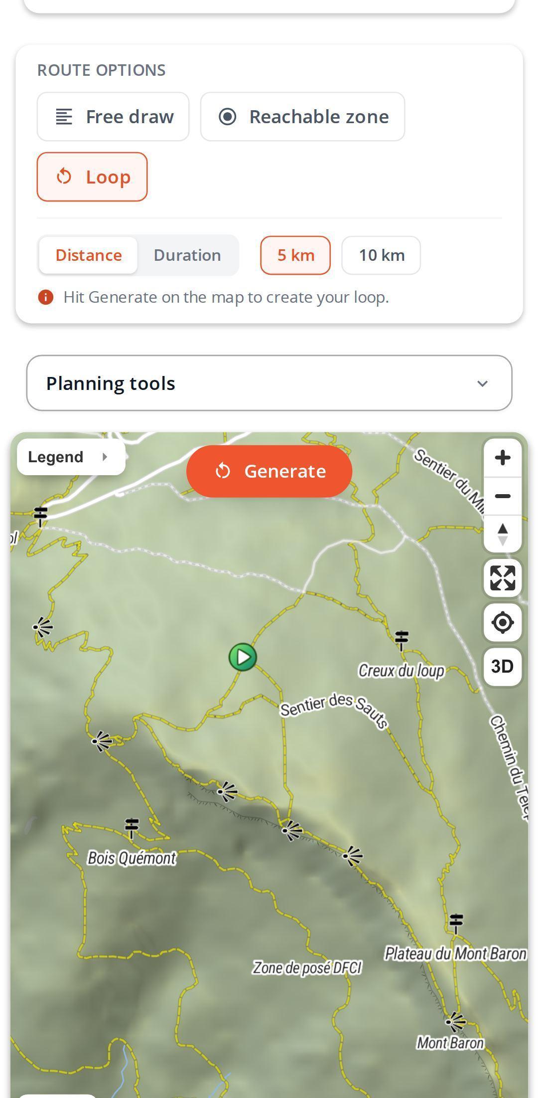
- In the planner, pick your activity and switch to loop mode in the route options.
- Aim for a distance or a time, then pick the value that suits you.
- Drop your start point on the map: a parking lot, a junction, your doorstep.
- Generate. The loop appears with its distance, estimated time and elevation gain; generate again for a different circuit from the same start.
The distance you ask for is a target rather than a promise to the meter. Because the loop sticks to real paths, it lands a little over or a little under, so check the stats before heading out.
Plan your own route
MapPlanner helps you calculate distances, elevation, duration and plan your hikes, runs and bike rides on an interactive map.
- Automatic distance & elevation calculation
- Topographic, satellite maps
- GPX/KML export for your GPS
- Real-time GPS tracking
Distance or time: which loop suits you?
Go by distance when you have a training goal. Go by time when what matters is getting back: home for lunch, back at your desk after a midday break. MapPlanner then turns the time into kilometers based on the pace of your activity. For hiking and cycling it assumes hilly ground, so the loop tends to come out slightly short rather than too long.
The time shown on the loop comes from our elevation-aware time estimate.
Circular routes for hiking, trail running and cycling
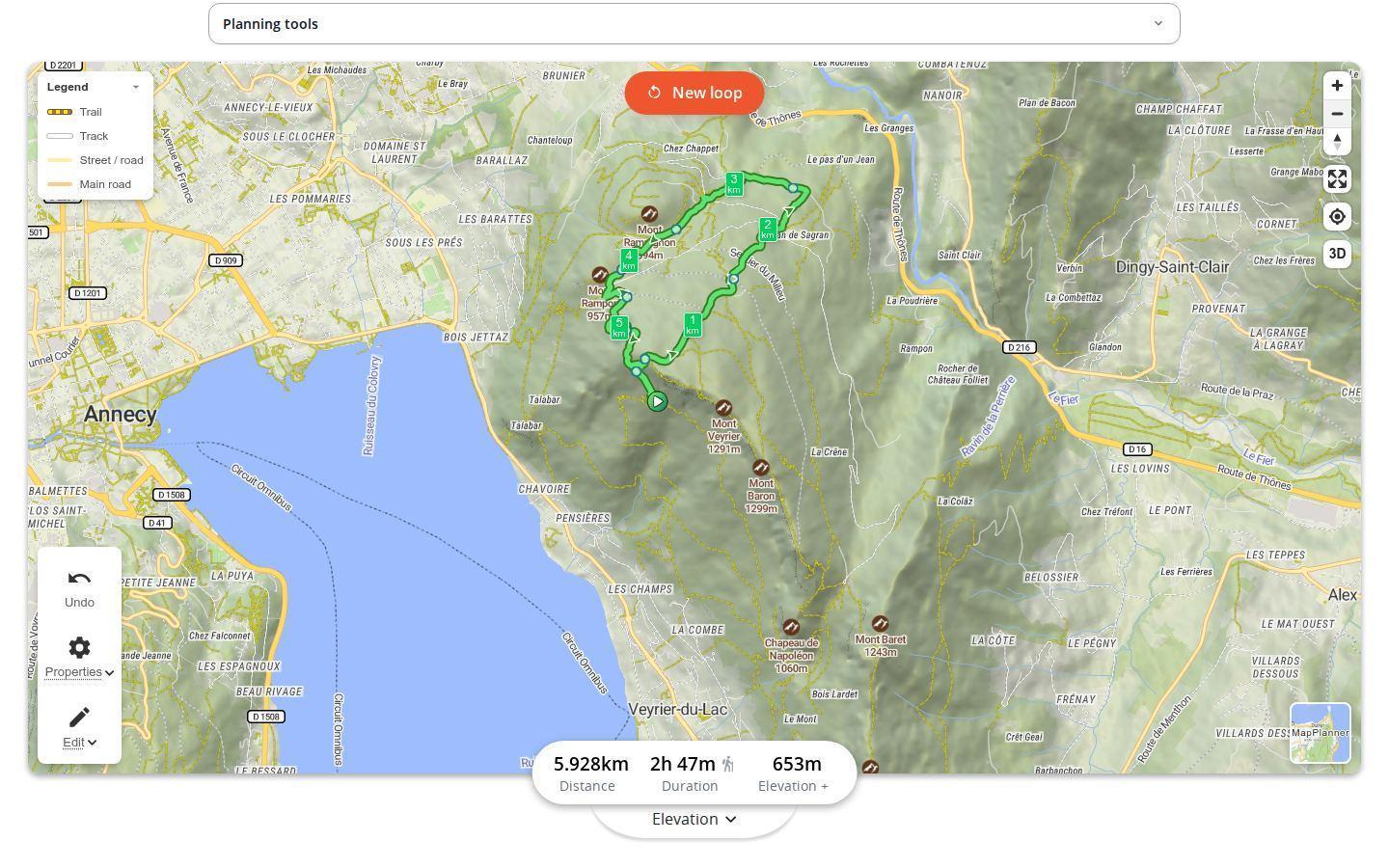
Above Annecy, from the slopes of Mont Veyrier, one generated loop shows 5.9 km, an estimated 2 h 47 min on foot and 653 m of elevation gain. Not many kilometers, yet a proper half-day out: the elevation figure tells you before you even lace up.
For trail runners, the generator breaks the routine. Same start, same distance, a new circuit every time, so your sessions change scenery instead of repeating the usual lap.
On a bike in unfamiliar country, a generated loop gives you a first feel for the area. Keep it as it is or adjust it.
A generated loop is still yours to edit
Once on the map, the loop behaves like any other route. Drag a point to take in a summit or skip a stretch of road, just as when you draw a route by hand. Then save it with a free account or export it as GPX for your watch.
Getting a loop you will enjoy
- Put the start on a path, not in the middle of a field or inside a building: the loop needs real ways to set off on.
- Generate two or three options before choosing: each heads off in a different direction.
- In the mountains, read the elevation gain as closely as the distance.
- Not sure where to go yet? The reachable area map first shows how far you can get from your start.
Free to try, longer loops with the Explorer plan
You can generate a few loops without an account. A free account unlocks more. The Explorer plan makes generation unlimited and adds longer distances and durations for big days out.
Found your start point? Generate your first loop in the planner.
Loop generator questions
Is the loop generator free?
Yes. Visitors can generate a few loops and a free account allows a few more. The Explorer plan makes it unlimited.
Which distances can I pick?
Short loops are free, by distance or by time. The Explorer plan adds longer values for bigger days out.
Why is my loop not exactly the distance I chose?
Because it follows real paths. MapPlanner keeps the circuit closest to your target, which may run slightly over or slightly under.
Does it work for running and cycling?
Yes. The loop is calculated for the activity you selected: running, hiking, cycling or walking.
Can I generate a loop on my phone?
Yes, in your phone's browser, with the same options as on a computer.


