Three days of hiking, two nights in mountain huts: Claire and Tom have drawn their loop around the massif, but where will they sleep? MapPlanner splits their trek into daily stages.
Does the first evening land near a hut or halfway along a ridge? Is day two too heavy on climbing? Once the full route is drawn, the multi-day hike planner places the nights along the line and shows each day's distance and elevation gain. All Claire and Tom have left to do is drag each night to the nearest hut.
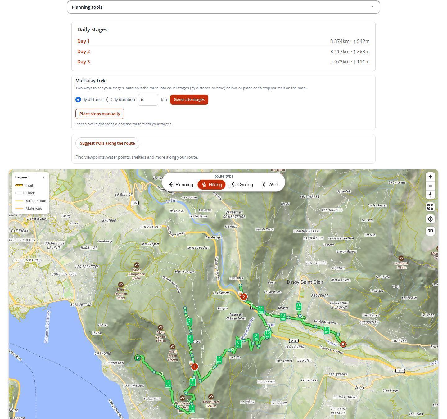
Splitting a hike into daily stages
The tool sits in the planner's planning tools whenever hiking is the selected activity.
- Draw the full route from start to finish. Until there is a route, the tool stays grayed out.
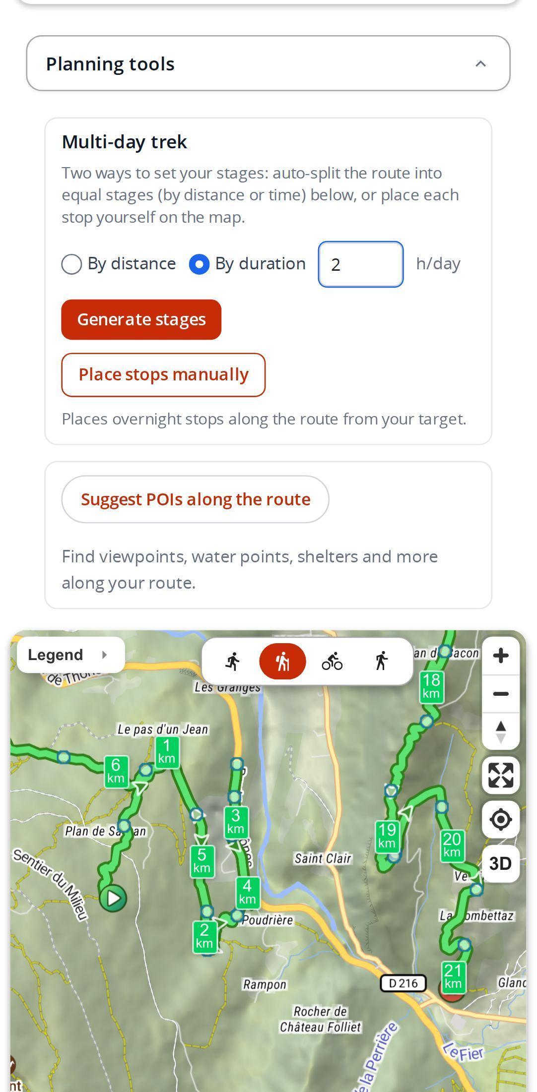
- Choose to split by distance or by duration, then set the value to your pace: kilometers or hours of walking per day.
- Generate the stages: MapPlanner places overnight stops at regular intervals along the line.
- Read the day-by-day summary, with the distance and elevation gain of each day.
Already know where you will sleep? Place the nights yourself: a dedicated mode lets you tap the line where the hut or bivouac spot is.
Plan your own route
MapPlanner helps you calculate distances, elevation, duration and plan your hikes, runs and bike rides on an interactive map.
- Automatic distance & elevation calculation
- Topographic, satellite maps
- GPX/KML export for your GPS
- Real-time GPS tracking
Stages by distance or by duration?
Distance suits regular walkers who know how many kilometers they cover in a day. Duration works better for a group or for broken ground: you think in hours on foot and MapPlanner turns them into kilometers assuming hilly terrain, so stages stay realistic on the climbs. To see how walking time is estimated, read about our elevation-aware duration.
Nights that fit the terrain
Generated stages are a starting point. Each night arrives as a bivouac, a numbered stop that you can drag along the line (to the hut, for instance) and whose place type you can change at will. A stop counts as a night as soon as its overnight box is checked; bivouacs, campsites and mountain huts count automatically. The day-by-day summary updates from these nights.
Once the route is saved, its page states the number of days and nights, then walks through each day with its stops: distance from the start, estimated passing time, altitude, breaks. The printable roadbook, available with a free account, follows the same day-by-day split.
Stages you will actually keep to
- Read each day's climbing as closely as its distance: 15 km in the mountains can be harder than 25 km on the flat.
- No night is placed right before the finish: the last day ends at the finish, not at a bivouac a kilometer from the parking lot.
- Between nights, add water points and supply stops. A good day is planned around its breaks too.
- Fit the nights to the huts before booking, not the other way around: the summary tells you straight away if a day gets too long.
Free for a short trek, the Explorer plan for long journeys
Automatic stage generation works without a subscription: a few tries for visitors, a few more with a free account and no limit with the Explorer plan. A try only counts when stages are actually placed.
Without a subscription, hiking route length and the total duration of a saved route are capped, which is enough for a short trek. The Explorer plan allows much longer routes and lifts the duration limit: that is the one for long-distance treks.
Your next trek starts with a line on the map: open the hiking planner, draw the full route and generate your stages.
Multi-day trek FAQ
Is splitting a route into stages free?
Yes, up to a point: it is limited for visitors, a little more generous with a free account and unlimited with the Explorer plan.
Why can't I see the tool in the planner?
It is only offered for hiking. Select that activity, draw a route, then open the planning tools.
Can I choose where to sleep myself?
Yes. Place the nights by hand or drag a generated stop. To make a stop count as a night, check the overnight box or choose a bivouac, campsite or mountain hut.
Can I print my trek stage by stage?
Yes. With a free account, the PDF roadbook of the saved route presents the trip day by day.
Does it work on a phone?
Yes. In your phone's browser, tap the line to place a stop, just as on a computer.


