A route without stops shows where you walk but never where you pause, so the time estimate forgets lunch and nobody knows where to refill. MapPlanner's numbered route stops fill that gap.
You place them right on the line: the water point before the climb, the pass where you eat, the hut where you sleep. Each one carries a place type, a break time and, if needed, an overnight stay. Breaks are added to the route's duration; the route page then lists your stops in order, each with an estimated time.
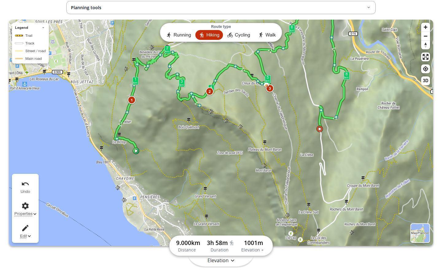
Placing a stop on your route
Once your route is drawn, choose to add a stop from the map's edit menu, then tap the line where you want it. A short form opens: place type, break time in minutes and a box to check if you are spending the night there. The stop takes its number on the line. Not quite in the right spot? Drag it.
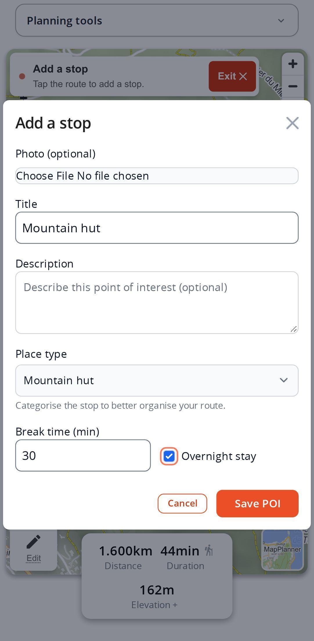
Place types are grouped into families: lodging (bivouac, campsite, mountain hut, shelter), supplies (water point, supplies), landmarks (viewpoint, mountain pass, summit), access (parking), alert (hazard) plus the generic waypoint. The list adapts to your activity: a mountain hut makes little sense on a run, so it does not show up there.
Plan your own route
MapPlanner helps you calculate distances, elevation, duration and plan your hikes, runs and bike rides on an interactive map.
- Automatic distance & elevation calculation
- Topographic, satellite maps
- GPX/KML export for your GPS
- Real-time GPS tracking
What stops change on your route
A duration that includes breaks. Break times are added to the total duration of the saved route, with the break share shown alongside. No more "4 hours" that turns into 5 on the trail.
A timeline of the day. On the route page, each stop appears in order with its distance from the start, its estimated passing time for your activity, its altitude, its break and any overnight stay.
Days instead of one long line. A stop marked as an overnight stay counts as a night, as does any bivouac, campsite or mountain hut; the route is then shown day by day. To split a long route automatically, see the multi-day hike planner.
Stops that travel with you. The printable roadbook includes your stops. The GPX export of the saved route sends them to your watch or GPS device as waypoints.
Stops follow the route's visibility: a private route keeps its stops private.
Stops for hiking, trail running and cycling
On a day hike, you might mark a viewpoint for the photo break, a water point before the last climb and thirty minutes of lunch at the pass. On a trek, a hut or a bivouac every evening. On a trail run, aid stations and tricky sections flagged as hazards. On a bike, passes, water points and the parking spot at the start.
So nothing slips through, MapPlanner can also suggest places along the route: viewpoints, water points, shelters and more. Tap a suggestion on the map and it becomes a numbered stop. To add your own photos and places, see points of interest on the map.
Where stops make the most difference
- Put the water point before the long climb, not after: that is where your bottle needs to be full.
- Be honest about breaks. Lunch rarely takes ten minutes: the total duration is only right if the breaks are.
- Keep stops for what matters: water, a night, a hazard, a meeting point. The line does the rest.
- Before you leave, read the timeline on the route page: the estimated arrival time at the hut tells you whether to start earlier.
Free, with unlimited stops on the Explorer plan
Stops work without an account, with a limited number per route. A free account allows more and lets you save the route with its stops. The Explorer plan makes them unlimited. Nights placed automatically by the multi-day tool do not count toward the limit.
Your breaks deserve a place on the map: draw your route in the planner and add your first stop.
Route stops: questions and answers
How many stops can I add for free?
Visitors can place a small number of stops per route and a free account a few more. With the Explorer plan there is no limit.
Are breaks included in the route duration?
Yes. Each stop's break time is added to the total duration of the saved route.
Do my stops go to my watch?
Yes, once the route is saved: its GPX export contains your stops as waypoints alongside the track.
Who can see my stops?
The same people who can see the route. If the route is private, so are its stops.
Can I add stops from my phone?
Yes. In your phone's browser, choose to add a stop from the edit menu, then tap the line.


