A route on a screen is good. A clear sheet in your pack is better. The MapPlanner PDF roadbook turns a route into a printable document you can also keep on your phone: topographic map, starting point, distance, elevation gain and estimated time, all on one page.
Hikers who like paper get their printout. Organizers hand the whole group the same sheet. And whoever stays at home knows exactly where you set off.
What goes into your hiking roadbook
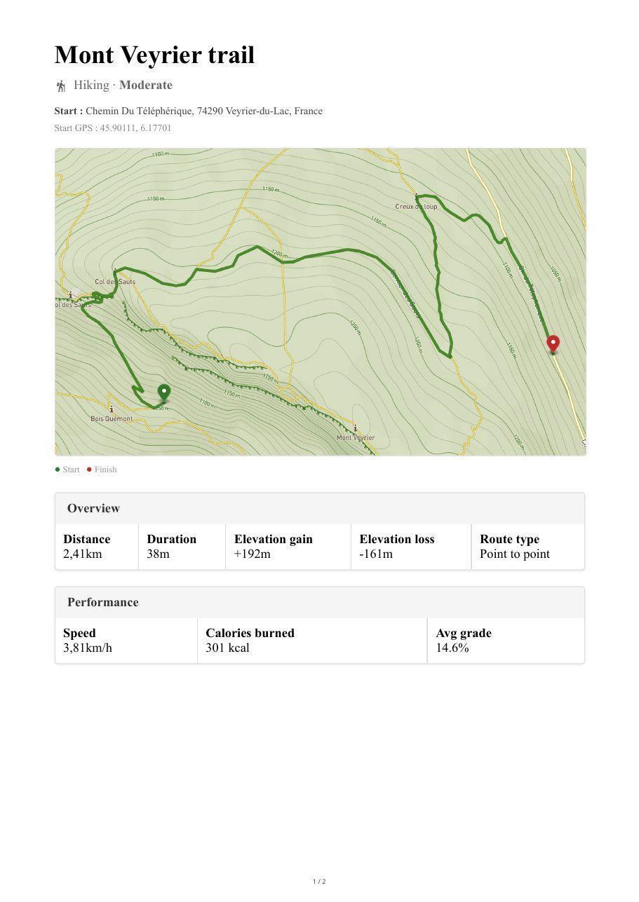
Page one gets straight to the point. At the top: the route name, the activity and the level. Right below: the start address and its GPS coordinates, ready to type into a GPS unit or send as the meeting point. Then a topographic map of the route with contour lines, start and finish.
Two tables sum up the outing:
- Overview: distance, estimated time, ascent and descent, loop or one-way;
- Performance: speed (pace for runs), calories and average slope.
The rest depends on the route. For hikes and rides, an elevation profile shows where the climbing happens, with minimum and maximum altitude; warnings flag steep sections and high altitude. A hike gets a rating of how technical the trail is, a bike ride a list of climbs ranked by category. A surface breakdown (paved, gravel, dirt, grass…) tells you what to expect underfoot or under your tires.
Your waypoints then set the thread of the document. A table lists each one with its name and type, distance from the start, planned break and your notes. Every leg between two waypoints then gets its own closer map. No waypoints? The route is split into readable stages automatically. Parking lots near the start are listed and marked on the map, along with those near the finish on a one-way route. For a multi-day route, a table sums up each day up to the evening stop. On the last page, a QR code links back to the route page.
Plan your own route
MapPlanner helps you calculate distances, elevation, duration and plan your hikes, runs and bike rides on an interactive map.
- Automatic distance & elevation calculation
- Topographic, satellite maps
- GPX/KML export for your GPS
- Real-time GPS tracking
How to download a route as a PDF roadbook
The roadbook is built from a saved route. Draw your itinerary in the route planner, by hand or by generating a loop, then save it with your free account. On the route page, the roadbook sits among the export options, next to the GPX, KML and TCX files. The PDF opens in a new tab, ready to print or save.
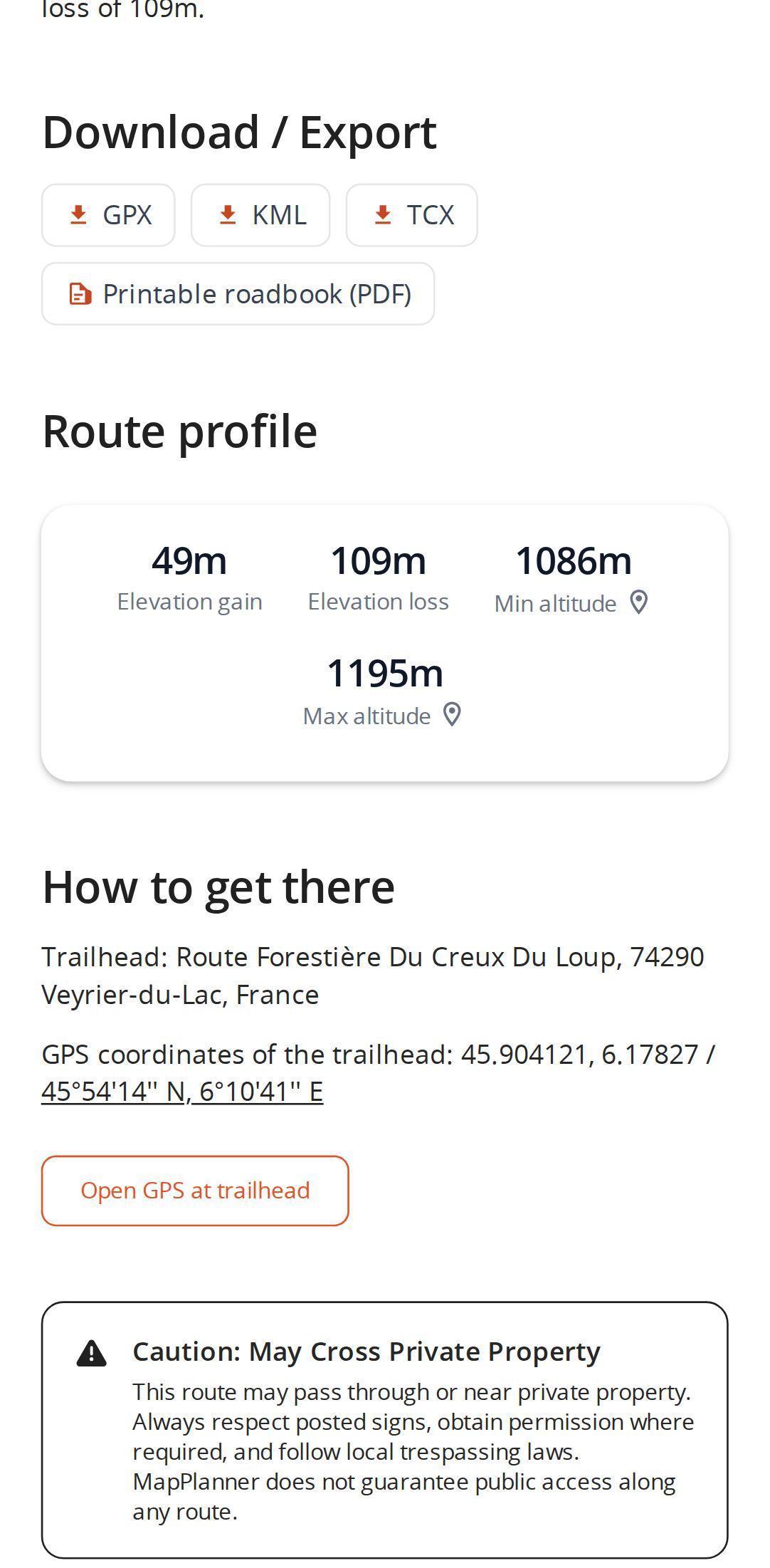
The same export works on other members' public routes, so a route you spot in the community can become your roadbook too. GPX, KML and TCX files are for loading the track onto a watch or GPS unit. The roadbook is for reading: it goes alongside the track rather than replacing it.
A roadbook for hiking, cycling and group outings
Group hikes. Send the PDF to everyone the night before. They all know the distance, the climbing and the exact meeting address.
Safety. Leave a copy with someone at home. If you are running late, they know which way you went.
No signal. Saved on your phone, the PDF opens offline. On paper, it needs no battery at all.
Long-distance trips. The day-by-day summary helps you plan nights, breaks and resupply points.
Cycling. The climbs and surfaces show at a glance whether the route suits your bike.
Tips for a roadbook that really helps
- Give the route a clear name before saving it: it heads the roadbook.
- Drop waypoints at key spots (spring, hut, junction) and add a note to each: it is printed next to the waypoint.
- Write a short route description; it is included in the document.
- Check the route before exporting and download the PDF again after any change.
- Download the roadbook before you leave, while you still have signal.
Your next route sheet starts on the map: draw your itinerary in the MapPlanner planner, save it and the roadbook is waiting on the route page.
PDF roadbook: your questions answered
Is the PDF roadbook free?
Yes. A free MapPlanner account is all you need, no subscription. If you are not signed in, MapPlanner offers to create your account or sign you in, then starts the download.
Can I read the roadbook on my phone without signal?
Yes. Once saved, the PDF opens like any other document on your phone, even offline. Just remember to download it before you set off.
What is the difference between the roadbook and a GPX file?
A GPX file (like KML and TCX) is loaded onto a watch, GPS unit or another app to follow the track. The roadbook is made to be read: map, start, summary tables, elevation profile and waypoints.
Does the roadbook work for multi-day routes?
Yes. When your waypoints mark overnight stops, the roadbook sums up each day with its distance, climbing and duration.
Which language is the roadbook in?
In the language of the site you download it from.


